Mini Itinerary
-
2:01pm 24 October 2026
Rome Roma to Montefiascone by Train
- I'm currently in Montefiascone.
Blog / Checkmate, Coast to Coast
1 March 2012
I get up early, as I know it's going to be a long one.
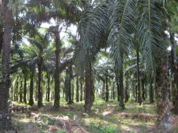
Some back roads take me out of Phunphin and over to highway 41. I only do a couple of kilometres on the highway before sneaking across to another small road on a dirt track. The small road, 4133, cuts off a corner and saves me a few kilometres. Then I join highway 44 and grind most of the day away.
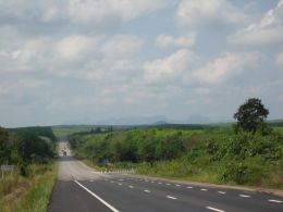
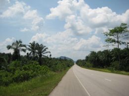
When is a highway not a highway? When it's a canal. This road is two lanes in each direction, with some 150 metres separating the carriageways. The original plan was to create a logistics 'land bridge' to transfer goods from coast to coast, via road, rail and pipeline - with the pipes and tracks running between the carriageways. As the locations for the two coastal ports have not yet been set, highway 44 doesn't run right to the coast on either end, and looks somewhat like an expensive white elephant. Judging from the light traffic and few roadside services, this road is waiting for some decisions to be made.
So, how did this mess come into being? The road was conceived as a replacement for a proposed canal through the peninsula that failed to materialise. There's rumours of Singapore officials bribing their Thai counterparts to hinder the completion of the project, canal or otherwise. Singapore's the largest port in the region and stands to lose a lot if shipping routes start to bypass it.
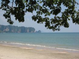
Once highway 44 comes to an end, I put in some distance on highway 4 before turning onto shady green back roads snaking through limestone karst. I roll into Ao Nang from the Hat Nopparat Thara end, and stop to gaze at the sea.
162km, 25.1km/h, 6hr27min, 6851km
Older: Same Mitochondria, Just More of Them | Newer: Ferry to Ko Lanta
Trip: The Return To The Sea
Distance today: 162km
Total distance: 6770km
Journey:
Phunphin พุนพิน
to Ao Nang อ่าวนาง
by Bike
162km
1 March 2012